Louis Armstrong New Orleans International Airport (MSY)
Driving Directions / Travel by Car
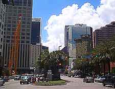
(New Orleans, Louisiana - LA, USA)
The Louis Armstrong International Airport (MSY) can be found on the western outskirts of New Orleans and is close to Kenner. On the northern side of New Orleans Airport you will find the I-10 interstate, which runs in an east-west direction and connects the I-310 to the west and the US-90 highway (Westbank Expressway) to the east.
On the southern side of New Orleans Airport, the Airline Highway is a notable road, leading to the main Access Road, which skirts the eastern edge of the grounds. Located on the northern side, the Veterans Memorial Highway is another prominent road and is sandwiched between both Loyola Drive and the Veterans Boulevard.
Many noteworthy landmarks are close to New Orleans Airport, such as La Freniere Park to the east, the Mississippi River to the south, and Lake Pontchartrain to the north. Also nearby, the Chateau Golf and Country Club lies on the northern side, off Vintage Drive and West Esplanade Avenue.
Directions to Louis Armstrong New Orleans International Airport (MSY) from the city center:
- New Orleans Airport is situated 16 miles / 10 km from the city center
- The I-10 interstate links directly to the terminal and concourses, and is the main highway in this area
- Alternatively, follow the Airline Highway and join the US-90 highway
- Follow the sign posts, which are clearly positioned along the route
Louis Armstrong New Orleans International Airport (MSY): Virtual Google Maps
