Louis Armstrong New Orleans International Airport (MSY)
Orientation and Maps
(New Orleans, Louisiana (LA), USA)
New Orleans could be easily summed up in a number of words - subtropical, southern, relaxed, friendly, crazy, fun, exciting and most of all, resilient. Bouncing back following its devastating hurricane in 2005, New Orleans has shown the world that its spirit cannot be blown away and the city of carnivals and parties is once again becoming an appealing tourist destination.
Famous for its Mardi Gras Parade each January, which is without doubt one of the biggest parties in the world, New Orleans's is also known for its southern-style, Cajun cuisine and blues music venues. Those arriving in the city by plane will fly into the nearby Louis Armstrong International Airport (MSY), on the western side of New Orleans. The airport serves mainly domestic flights and is easy to find, standing close to the I-10 interstate.
Louis Armstrong New Orleans International Airport (MSY) Maps: Important City Districts
Further modes of long-distance transportation available in the city include Greyhound buses at the Union Passenger Terminal along Loyola Avenue, on the western side of the city's Warehouse District. Amtrak also operates here, linking New Orleans with Chicago, Jackson and Memphis.
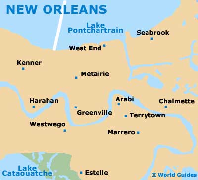
Based around the winding Mississippi River, New Orleans is edged to the north by the vast Lake Pontchartrain and many locations are described in relation to these two natural landmarks, being either 'lakeside' or 'riverside'. Particularly famous is the cities French Quarter, which is full of so many historical gems that it has become a listed National Historic District. Jackson Square is the perfect starting point for those wishing to explore this area, often being full of street entertainment.
USA Map

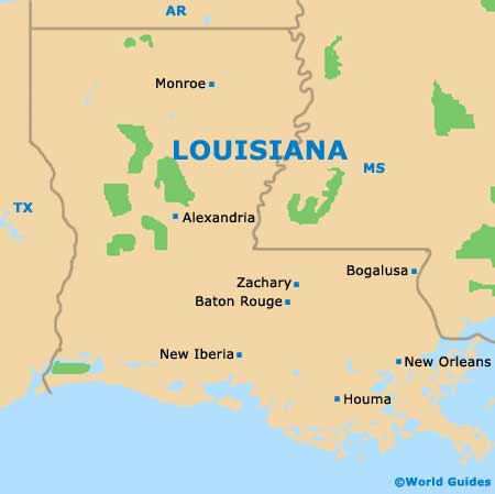
Louisiana Map
New Orleans Map